Toolbar |
|
Pop-up | data point > Reprocess As Land/Water/Shallow Water (2D/3D views, Selection window) |
Toolbar |
|
Pop-up | data point > Reprocess As Land/Water/Shallow Water (2D/3D views, Selection window) |
The Reprocess Data As... set of commands in Subset Editor can be used to change the state of data from one type to another, specifically land, water or shallow water. This conversion reprocesses the data using settings for the selected type, resulting in different values for various attributes relevant to the output type. A few specific attributes to check are:
• Optech Status: The value for this attribute should be “Reprocessed” after running this command.
• Processing Mode: This attribute will be changed to match the data type that was selected for reprocessing. Further processes run on the selected point(s) will be processed using this state.
• Classification: The classification label of the selected point(s). This will change to match the selected type, for example, if points are reprocessed from "water" to "land", then the classification label of the selected point(s) will change from "41/42" (water surface/ derived water surface) and "40" (bathymetric point) to "0" (unclassified). The classification labels are based on the ASPRS classification scheme1 (shown below) and all non-water points are labelled as unclassified.
Classification Value (Bits 0:4) | Meaning |
|---|---|
0 | Created, Never Classified |
1 | Unclassified |
2 | Ground |
3 | Low Vegetation |
4 | Medium Vegetation |
5 | High Vegetation |
6 | Building |
7 | Low Point (Noise) |
8 | Model Key-Point (Mass Point) |
9 | Water |
10 | Reserved for ASPRS Definition |
11 | Reserved for ASPRS Definition |
12 | Overlap Points |
13-31 | Reserved for ASPRS Definition |
40 | Bathymetric point (e.g., seafloor or riverbed; also known as submerged topography) |
41 | Water surface (sea/river/lake surface from bathymetric or topographic bathymetric lidar; distinct from Point Class 9, which is used in topographic only lidar and only designates “water,” not “water surface”) |
42 | Derived water surface (synthetic water surface location used in computing refraction at water surface) |
43 | Submerged object, not otherwise specified (e.g., wreck, rock, submerged piling) |
44 | International Hydrographic Organization (IHO) S-57 object, not otherwise specified |
45 | No-bottom-found-at (bathymetric lidar point for which no detectable bottom return was received) |
This set of commands is available in a drop-down list from a toolbar button in the Subset Editor toolbar or from the right-click context menus in the 2D view, 3D view or Selection window.
Procedure
1. Load a subset into the Subset Editor.
2. Select the points in the subset that need to be reprocessed.
3. If necessary, create a subselection of those points by selecting points in the Selection window.
4. Select the required Reprocess As command.
A warning message is displayed confirming that the points will be reprocessed and cannot be undone.

5. Click Yes to reprocess the selected points.
A progress bar is displayed showing the reprocessing progress.
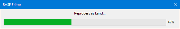
When complete, the progress bar will close and a message will be displayed in the Output window with the start and end times for the processing.
1 http://www.asprs.org/wp-content/uploads/2019/03/LAS_1_4_r14.pdf
https://www.asprs.org/wp-content/uploads/2010/12/LAS_Domain_Profile_Description_Topo-Bathy_Lidar.pdf


