General | Used in atlases to show areas in the middle latitudes. Good for regions within a few degrees of latitude and on one side of the equator. One example, the Kavraisky No. 4, is an Equidistant Conic projection in which standard parallels are chosen to minimize overall error. Not conformal, perspective, or equal area. A blending of Lambert Conformal Conic and Albers Equal Area Conic. |
Directions | Reasonably accurate but distortion increases away from standard parallels. |
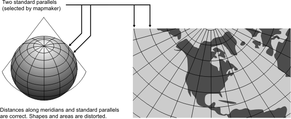
Distances | True only along meridians and along one or two standard parallels. |
Areas | Reasonably accurate but distortion increases away from standard parallels. |
Shapes | Reasonably accurate but distortion increases away from standard parallels. |
Type | Conic. Mathematically projected onto a cone tangent at one parallel or conceptually secant at two parallels |
History | Prototype was developed by Ptolemy in the year 150 and improved by De l’Isle around 1745. |
| |
Note | Not directly supported. Maps must be transformed before being used. |
(United States Geological Survey, n.d.) | |