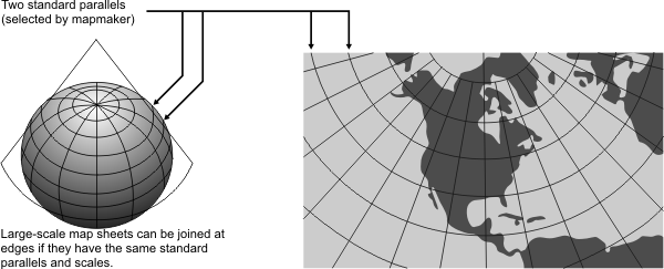
General | Used to show a country or region that is principally east-west in extent. One of the most widely used map projections in the United States. It looks like Albers Equal Area Conic, but graticule spacings differ. The Lambert Conformal Conic projection retains conformality. Conformal but not perspective, equal area, or equidistant. |
Directions | Reasonably accurate. |
Distances | True along standard parallels. Reasonably accurate elsewhere in limited regions. |
Areas | Distortion is minimal at the standard parallels but increases with distance. |
Shapes | Distortion is minimal at the standard parallels but increases with distance. Shapes on large-scale maps of small areas are essentially true. |
Type | Conic. Mathematically projected onto a cone conceptually secant at two standard parallels. |
History | Presented by Johann Heinrich Lambert in 1772. |
| |
Note | Directly supported. |
(United States Geological Survey, n.d.) | |