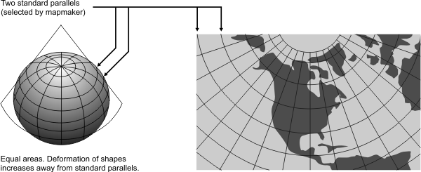
General | Suited for large areas that are mainly east-west in extent and that require equal-area representation. Used for thematic maps. Maps of adjacent areas can be joined at their edges if they have the same standard parallels and scale. Not conformal, perspective, or equidistant. |
Directions | Reasonably accurate in limited regions. |
Distances | True on both standard parallels. |
Scale | True only along standard parallels. The maximum scale error is calculated at 1.25% on a map of the conterminous states with standard parallels of 29.5 degrees North and 45.5 degrees North. |
Areas | Proportional to the same areas on Earth. |
Type | Conic. Mathematically projected onto a cone conceptually secant at two standard parallels |
History | Presented by H. C. Albers in 1805. |
| |
Note | Not directly supported. Maps must be transformed before being used. |
(United States Geological Survey, n.d.) | |