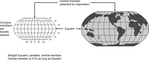
General | Used in Goode’s Atlas, National Geographic’s world maps since 1988, and in a growing number of other publications. May replace Mercator in classrooms. Uses tabular coordinates instead of mathematical formulas to make the Earth “look right”. This achieves a better balance of size and shape of high-latitude lands than Mercator, Van der Grinten, or Mollweide. Russia, Canada, and Greenland appear truer in size but Greenland looks compressed. Not conformal, equal area, equidistant, or perspective. |
Directions | True along all parallels and the central meridian. |
Distances | Constant along the equator and other parallels, |
Scale | True along 38° N and S. Constant along any given parallel The same along N and S parallels that are an equal distance from the equator. |
Distortion | All points contain some distortion, with the greatest near the poles and lowest along the equator and within 45° of centre. |
Type | Pseudocylindrical or orthophanic (“right appearing”) |
History | Presented by Arthur H. Robinson in 1963. |
| |
Note | Not directly supported. Maps must be transformed before being used. |
(United States Geological Survey, n.d.) | |