General | Used almost exclusively for large-scale mapping in the United States until the 1950s. Now nearly obsolete and no longer used by USGS for new plotting in its Topographic Map series. Best suited to areas with a north-south orientation. A compromise of many properties. Not conformal, perspective, or equal area. |
Directions | True only along the central meridian. |
Distances | True only along each parallel and along the central meridian. |
Areas | True only along the central meridian. Distortion increases away from the central meridian. |
Shapes | True only along the central meridian. Distortion increases away from the central meridian. |
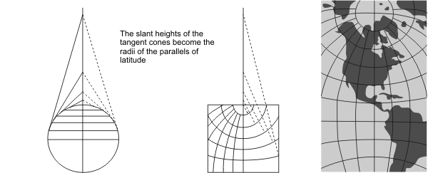
Type | Conic. Mathematically based on an infinite number of cones tangent to an infinite number of parallels |
History | Thought to have originated around 1820 by Hasslet. |
| |
Note | Directly supported. |
(United States Geological Survey, n.d.) | |