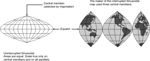
General | Used in atlases to show distribution patterns, by USGS to show prospective hydrocarbon provinces and sedimentary basins of the world, and for maps of Africa, South America, and other large areas that are mainly north-south in extent. An easily plotted, equal-area projection for world maps. A map may have a single central meridian or several central meridians (interrupted form). Graticule spacing retains the equivalence of area. Not conformal, perspective, or equidistant. |
Distances | True along all parallels and the central meridian(s). |
Areas | Proportional to those same areas on the Earth. |
Shapes | Increasingly distorted away from the central meridian(s) and near the poles. |
Type | Pseudocylindrical. Mathematically based on a cylinder tangent to the equator |
History | Used by Cossin and Hondius beginning in 1570. Also known as the Sanson-Flamsteed projection. |
| |
Note | Not directly supported. Maps must be transformed before being used. |
(United States Geological Survey, n.d.) | |