Pop-up | Line Digitizer > Geodesic Area Digitizer > Geodesic |
Use with the Create Line Feature or Create Area Feature command.
A geodesic line is the shortest possible distance between two points. For example, with a global map view, a geodesic line with two points, one in Whitehorse, Canada and one in Oslo, Norway would be drawn as a straight line crossing the Arctic circle as opposed to being drawn parallel to a line of latitude.
Related commands:
Procedure
1. Select the Digitize Geodesic Line command.
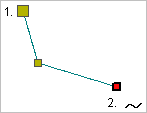
2. Click once at the location of the first point (1).
3. Do one of the following:
• Click at the location of the second point.
• Press and hold the mouse button and drag the second point to its location then release the button.
Pressing and dragging will give you a preview of the line. |
4. Continue until all points are added.
5. End or close the line.
Pop-up | Line Digitizer > End Line Line Digitizer > Close Line |
Key | <End> <Home> |
Close line joins the first point in the line to the last point.
The new line feature is created.