The BASE Surface is a 2.5-D (dimensional) data storage format consisting of nodes on a grid. Attributes such as depth are stored at each node. Normally a grid structure consists of regularly spaced points; however, a BASE Surface can be created using the original XY position of specific soundings. For example, depending on the chosen gridding method, a BASE Surface can retain the original XY coordinates of the shoalest depths.
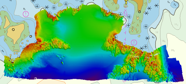
An example of a BASE Surface is shown below.
The BASE Surface can be used in a variety of disciplines and can be created and manipulated to suit project specific needs. For example, a BASE Surface can be calculated using the results of a TPU model.
Hydrographic Surveyors can use a BASE Surface to:
• Represent the sea floor using a shoal-biased method to ensure safety of navigation of waterways.
• Create topographic and bathymetric lidar products.
Other users, including marine geologists, coastal zone and fisheries managers, and ocean engineers, can also use a BASE Surface to:
• Represent a multitude of spatial attributes.
• Obtain a highly detailed representation of the seabed.
• Determine the success of their projects based on work with the various attributes of the surface.
These are just a few examples that illustrate the utility of the BASE Surface.