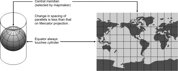
General | Used to represent the entire Earth in a rectangular frame. Popular for world maps. Looks like Mercator but is not useful for navigation. Displays poles as straight lines. Not equal area, equidistant, conformal, or perspective. |
Directions | True only along the equator. |
Distances | True only along the equator. In high latitudes, distortion is extreme. |
Scale | Avoids some of the scale exaggerations of Mercator, but distorts both shapes and areas. |
Areas | Distorted. In high latitudes, distortion is extreme. |
Shapes | Distorted. In high latitudes, distortion is extreme. |
Type | Cylindrical Mathematically projected onto a cylinder tangent at the Equator |
History | Presented by O.M. Miller in 1942. |
| |
Note | Not directly supported. Maps must be transformed before being used. |
(United States Geological Survey, n.d.) | |