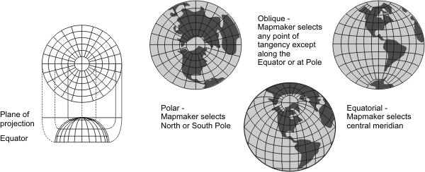
General | Useful for airline distances from a centre point of projection and for seismic and radio work. Oblique aspect used for atlas maps of continents and world maps for radio and aviation use. Polar aspect used for world maps, maps of polar hemispheres, and the UN emblem. |
Directions | True only from the centre point of projection. |
Distances | True only from the centre point of projection. Correct between points along straight lines through the centre. Any straight line drawn through the centre point is a great circle. All other distances are incorrect. |
Areas | Distortion increases away from the centre point. |
Shapes | Distortion increases away from the centre point. |
Type | Azimuthal. Mathematically projected onto a plane tangent to any point on the globe. The polar aspect is tangent only at a pole. |
| |
Note | Not directly supported. Maps must be transformed before being used. |
(United States Geological Survey, n.d.) | |