General | Used in conjunction with Mercator by some navigators to find the shortest path between two points, Used in seismic work because seismic waves tend to travel along great circles. Perspective (from the Earth’s centre onto a tangent plane) but not conformal, equal area, or equidistant. |
Directions | True only from the centre point of projection. Any straight line drawn on the Gnomonic map is on a great circle. |
Scale | Increases rapidly away from the centre point. |
Areas | Distortion increases away from the centre point. |
Shapes | Distortion increases away from the centre point. |
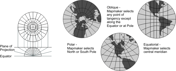
Type | Azimuthal. Geometrically projected onto a plane. The point of projection is the centre of a globe |
History | Considered to be the oldest true projection map and is ascribed to Thales, the father of abstract geometry, who lived in the sixth century B.C. |
| |
Note | Directly supported. |
(United States Geological Survey, n.d.) | |