Menu | File > Export > Points |
Export the values from a coverage to a point cloud in CSAR format. The source coverage can be a raster surface, point cloud or variable resolution surface.
This command can also export data to LAS format. See Export Points to LAS.
Interface
The Export Points to CSAR command uses the following dialog box:
Option | Description |
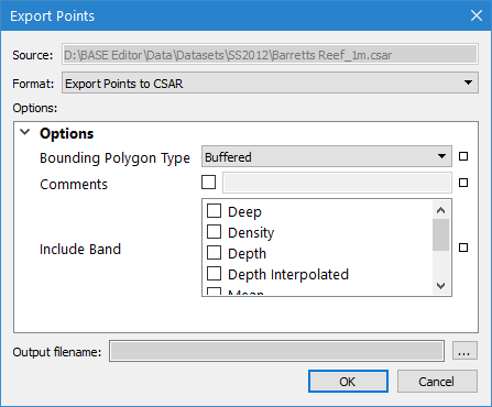
Source | The name and location of the input file. The Source is defined by the coverage that was selected at the time the command was initiated. This setting cannot be changed. |
Format | The output format for the resulting CSAR point cloud file. |
Options | The options for the selected output format. The available options will differ based on the selection in the Format drop-down list. If you hover the mouse cursor over the name of an option, a brief description of the option is displayed in a screen tip. |
Status Indicators
| Each option has a status indicator box beside the field. If the field has not been populated, or is populated with a default value, the box is coloured white. When a value is entered or a default value is changed, the status indicator box changes to grey to indicate it is no longer in the default state. If an option is mandatory and its field is empty, the status indicator box is coloured red. Fields can be returned to their default state by clicking the status indicator box and selecting “Reset”. |
Output filename | The name and location for the output point cloud file. 1. Click the browse button (...) to specify a name and location. |
Procedure: Export to CSAR
1. Select the parent layer of the coverage to export.
2. Select the Export Points command.
The Export Points dialog box is displayed.
3. Select CSAR for the output Format.
4. Define any necessary Options.
5. Specify a name and location for the Output filename.
6. Click OK.
The data is exported to a new point cloud.
